Description
Overview
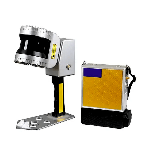
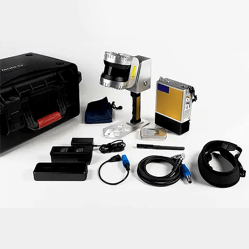
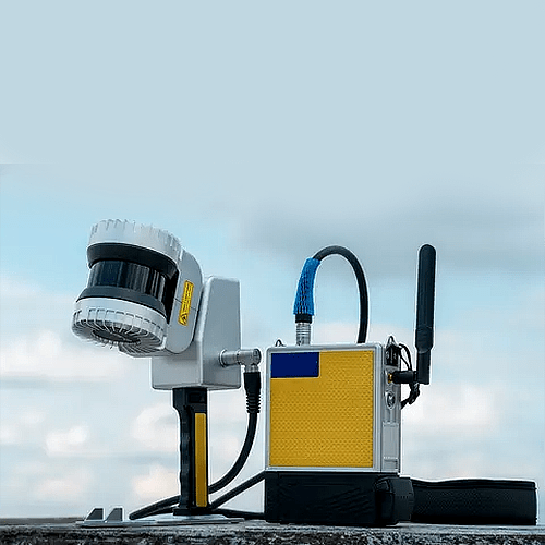
Asset Track Pro Lidar Scanner, representing a paradigm shift in portability and precision. This device is characterized by its lightweight build, flexibility, and user-friendly operation. With the incorporation of cutting-edge high-precision SLAM technology, it has the capability to generate 3D reconstructions of both indoor and outdoor environments without relying on GNSS positioning. This empowers professionals to effortlessly capture point cloud data with centimeter-level accuracy while in motion. Furthermore, the inclusion of proprietary processing software enables efficient post-processing of point cloud data and facilitates a wide range of applications.
Features
- Rapid Scanning
- Portable Efficiency
- Precision Data
- Ample Storage
- Live Data Display
- Versatile Integration
- Versatile Applications
Technical Specifications
| Lidar Channels | 32 channels |
| Points per Second | 655,000 |
| Laser Product Classification | Level 1 |
| Laser Wavelength | 865 nm |
| Scanning Accuracy | 0.03 m to 0.05 m |
| Maximum Range | 120 m |
| Data Formats | DAT, PCD, LAS |
| Housing | Aircraft-grade aluminum (high protection and high interference resistance) |
| Power Supply | 12 V to 24 V DC / 25 W |
| Working Time | 3 hrs (one battery) |
| Storage | IT (expandable) |
| Working Environment | Indoor and outdoor |
| Working Temperature | -4 °F to 140 °F (-20 °C to 60 °C) |
| Protection Level | IP 54 |
| Dimension (Handheld) | 11.61 in x 7.75 in x 3.92 in (295 mm x 197 mm x 99.7 mm) |
| Dimension (with Handle) | – |
| Dimension (Host) | 5.03 in x 7.28 in x 2.04 in (128 mm x 185 mm x 52 mm) |
| Weight (Handheld) | 3.52 lb (1.6 kg) |
| Weight (Host) | 2.25 lb(1 kg) |